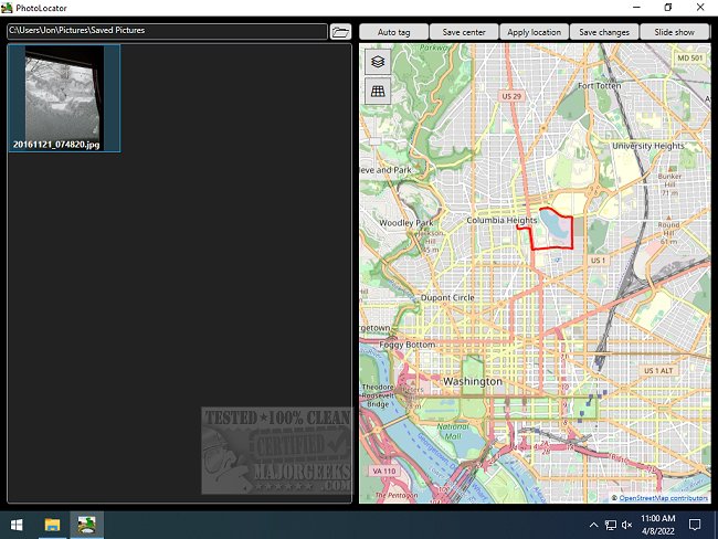
PhotoLocator has recently released version 2025.4.28.0, enhancing its functionality as a robust geotagging application. The app specializes in importing GPS traces from GPX and KML files and seamlessly applying GPS positions to JPEG files by synchronizing them with image timestamps. One notable feature is its ability to import GPS tags from pre-geotagged photos, providing users with flexible options for setting locations either automatically via timestamps or manually through copy/pasting from other files or selecting points on a map.
The app is designed to perform a lossless update of the EXIF data, ensuring that the original image quality is maintained while adding geolocation information. Users can obtain KML files directly from Google Maps location history, while various sports and location tracking apps facilitate the export of GPX files.
In addition to its geotagging capabilities, PhotoLocator boasts a full-screen slideshow feature that includes a small display of the location map. This allows users to create dynamic slideshows by dragging and dropping files or folders, which can span multiple directories.
Overall, PhotoLocator is an excellent tool for photographers and travelers looking to enrich their images with precise geolocation details, offering a range of features for both casual and professional use.
Extended Features and Future Prospects:
Looking ahead, future updates to PhotoLocator could include enhanced integration with social media platforms for easy sharing of geotagged images, as well as advanced analytics that provide insights into user locations over time. Additionally, incorporating AI-driven suggestions for optimizing geotagging based on user behavior and preferences could further elevate the app's functionality. With the rise of immersive technologies, a feature allowing users to create virtual tours from their geotagged images could also be a valuable addition
PhotoLocator 2025.4.28.0 released
PhotoLocator is a geotagging app capable of importing GPS traces from GPX and KML files and applying the GPS positions to JPEG files by synching with image timestamps.