The release of Google Earth version 7.3.6.10441 brings users an enhanced experience in exploring our planet from a unique perspective. This powerful application allows users to virtually "fly" anywhere on Earth, offering an extensive array of features such as satellite imagery, detailed maps, and immersive 3D representations of buildings and terrains. From the breathtaking views of outer space down to the depths of ocean canyons, Google Earth serves as an invaluable tool for geographical exploration.
With Google Earth, users can easily delve into specific locations, thanks to its integration with Google Search, which provides a wealth of geographic information at one's fingertips. The platform not only showcases stunning locales like Maui and Paris but also highlights essential points of interest such as restaurants, hospitals, schools, and more.
Key features of Google Earth include:
- Navigation Controls: Seamlessly look around, move, and zoom into any desired location.
- Sun and Shadows: Observe animated shadows that shift across the landscape, adding realism to the viewing experience.
- 3D Buildings: Explore hundreds of photo-realistic buildings in various major cities worldwide.
- Imagery Date Information: Gain insights into when specific images were captured.
- Support for Multiple Languages: Access the application in various languages for broader accessibility.
- Interactive Content: View Flash videos within placemark balloons for enriched location information.
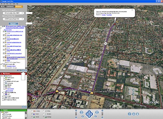
Users can effortlessly navigate by typing in an address, zooming in to see their neighborhood, and searching for amenities like schools, parks, restaurants, and hotels. The application also provides driving directions, allows for tilt and rotation of views to observe 3D terrain, and enables users to save and share their favorite locations and searches. Additionally, users can personalize their experience by adding annotations to their maps.
In summary, the latest version of Google Earth continues to enhance the way people interact with geographic information, making it an indispensable tool for both casual users and serious geographers alike. As technology advances, future updates may introduce even more interactive features, improved imagery, and a broader database of geographic data, further enriching user experience and exploration possibilities
With Google Earth, users can easily delve into specific locations, thanks to its integration with Google Search, which provides a wealth of geographic information at one's fingertips. The platform not only showcases stunning locales like Maui and Paris but also highlights essential points of interest such as restaurants, hospitals, schools, and more.
Key features of Google Earth include:
- Navigation Controls: Seamlessly look around, move, and zoom into any desired location.
- Sun and Shadows: Observe animated shadows that shift across the landscape, adding realism to the viewing experience.
- 3D Buildings: Explore hundreds of photo-realistic buildings in various major cities worldwide.
- Imagery Date Information: Gain insights into when specific images were captured.
- Support for Multiple Languages: Access the application in various languages for broader accessibility.
- Interactive Content: View Flash videos within placemark balloons for enriched location information.
Users can effortlessly navigate by typing in an address, zooming in to see their neighborhood, and searching for amenities like schools, parks, restaurants, and hotels. The application also provides driving directions, allows for tilt and rotation of views to observe 3D terrain, and enables users to save and share their favorite locations and searches. Additionally, users can personalize their experience by adding annotations to their maps.
In summary, the latest version of Google Earth continues to enhance the way people interact with geographic information, making it an indispensable tool for both casual users and serious geographers alike. As technology advances, future updates may introduce even more interactive features, improved imagery, and a broader database of geographic data, further enriching user experience and exploration possibilities
Google Earth 7.3.6.10441 released
Google Earth lets you fly anywhere on Earth to view satellite imagery, maps, terrain, 3D buildings, from galaxies in outer space to the canyons of the ocean.